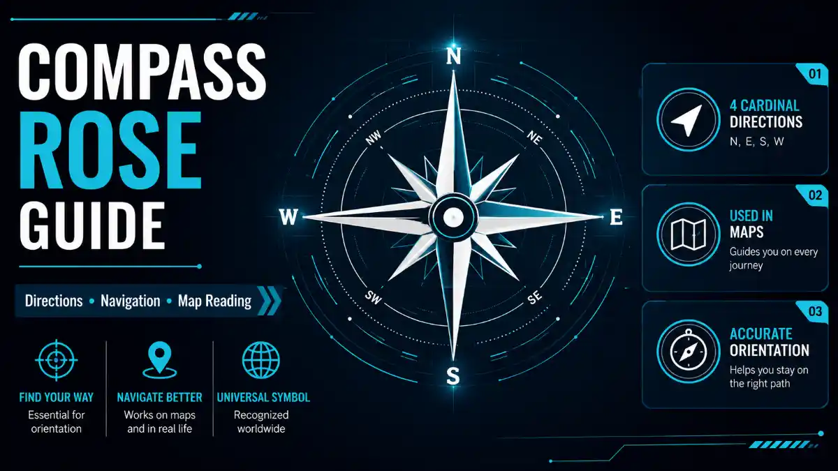

A compass rose is a symbol on a map or chart that shows direction. It commonly displays the four cardinal directions – north, east, south, and west – and often includes intermediate directions such as northeast and southwest. More detailed compass rose symbols add bearings measured in degrees for precise navigation.
An 8-point compass rose: cardinal directions sit 90° apart, with intermediate directions filling the 45° gaps between them.
This guide explains what each part of a compass rose means, how to read compass rose directions on a real map, and how the symbol connects to broader navigation concepts like true north and magnetic declination.
Cardinal vs. Intermediate Directions
Cardinal directions are the four primary compass points – North (N), East (E), South (S), West (W) – spaced exactly 90 degrees apart. Intermediate directions (also called intercardinal directions) fill the space between them: Northeast (NE), Southeast (SE), Southwest (SW), Northwest (NW), each sitting 45 degrees from its nearest cardinal points.
Together, these eight directions make up the standard 8-point compass rose, the version most people learn first and the one printed on most everyday maps.
Quick-Reference Direction and Bearing Table
| Direction | Abbreviation | Bearing |
| North | N | 0° / 360° |
| Northeast | NE | 45° |
| East | E | 90° |
| Southeast | SE | 135° |
| South | S | 180° |
| Southwest | SW | 225° |
| West | W | 270° |
| Northwest | NW | 315° |
Read More: Compass Rose
A bearing is a direction expressed in degrees, measured clockwise from north. This numeric scale is what makes more detailed compass rose symbols – 16-point and 32-point versions – possible, since each one simply divides the 360-degree circle into smaller, even segments.
How to Read a Compass Rose on a Map
- Find north first. Look for the “N” label, the longest arrow, or a star or fleur-de-lis marking.
- Confirm the map’s orientation. Most maps place north at the top, but not all do – verify it rather than assuming.
- Trace the remaining cardinal points. Moving clockwise from north gives east, south, then west, each 90 degrees apart.
- Locate intermediate directions if shown. Northeast, southeast, southwest, and northwest sit at the 45-degree marks.
- Use exact bearings when precision matters. A graduated rose lets you read a specific degree value instead of estimating.
Practical Example
If a coffee shop sits west of a train station, and a bookstore sits south of that coffee shop, the bookstore’s general direction from the station combines both movements – it lies southwest of the station overall. This is a useful way to describe relative position, but it isn’t a substitute for measuring an exact bearing: a location that’s mostly west and only slightly south won’t sit at a true 225° southwest bearing. For precise direction, measure the angle or compare the exact north-south and east-west distance between the two points.
Compass Rose vs. Map Legend vs. Physical Compass
These three map elements are often introduced together, but each serves a different function.
| Element | What It Shows | Where You’ll Find It |
| Compass rose | The map’s directional orientation (N, S, E, W, and often more) | Printed directly on the map |
| Map legend/key | What symbols, colors, or lines on the map represent | Usually a separate box on the map |
| Physical compass | Real-time alignment with Earth’s magnetic field to indicate magnetic north | A handheld instrument, used alongside a map |
A physical compass doesn’t point to one exact magnetic location – it aligns with the horizontal component of Earth’s local magnetic field, which is why compass readings can vary slightly depending on where you’re standing.
Types of Compass Rose Symbols
The complexity of a compass rose design usually reflects how much precision its users need.
| Design | Total Points | Degrees Apart | Common Use |
| 4-point | 4 | 90° | Basic educational maps |
| 8-point | 8 | 45° | Everyday maps, introductory geography |
| 16-point | 16 | 22.5° | Trail maps, detailed regional charts |
| 32-point | 32 | 11.25° | Traditional nautical charts |
The 16-point version adds North-Northeast, East-Northeast, East-Southeast, South-Southeast, South-Southwest, West-Southwest, West-Northwest, and North-Northwest by splitting each existing gap in half. The 32-point rose repeats that process, producing the detailed graduated design historically used by sailors plotting a course by hand. Nautical charts typically show this design as two circles – a larger outer ring and a smaller inner ring – used to distinguish true and magnetic bearings.
Advanced Compass Rose Concepts
The following details go beyond basic map reading and become relevant mainly in navigation, surveying, and marine or aviation contexts.
True North, Magnetic North, and Grid North
| Type of North | What It Refers To | Fixed or Variable |
| True north | The geographic North Pole | Fixed |
| Magnetic north | The direction a compass needle aligns to, based on Earth’s magnetic field | Shifts over time and by location |
| Grid north | The direction of a map’s vertical coordinate grid lines (e.g., UTM) | Varies slightly by map projection |
Magnetic declination is the angle between magnetic north and true north, and it changes depending on location and drifts gradually over time. On nautical charts, the outer circle of a compass rose represents true north, which stays fixed, while the inner circle represents magnetic north, which shifts as Earth’s magnetic field changes. Navigators account for this difference – sometimes called variation – when converting between a map bearing and a compass reading.
Grid north becomes relevant mainly on maps using a coordinate grid system, where its small difference from true north is called grid convergence. For everyday map reading, this distinction rarely matters, but it’s a standard consideration in land surveying and precise outdoor navigation.
Frequently Asked Questions
Why does a compass rose sometimes show two circles instead of one?
On nautical charts, the two-circle design separates true north from magnetic north. The larger outer circle marks true north, which stays fixed relative to the geographic North Pole, while the smaller inner circle marks magnetic north, which shifts over time as Earth’s magnetic field changes. Navigators use both rings together to convert accurately between map bearings and compass readings.
Is a compass rose the same as a compass?
No. A compass rose is a printed symbol on a map showing fixed directional orientation, while a physical compass is a handheld instrument whose needle aligns with Earth’s local magnetic field in real time. Navigators typically use both together – orienting a map’s compass rose to match a compass needle reading to determine an accurate real-world direction.
Why do some compass rose designs use terms like “north by east”?
That labeling comes from the traditional 32-point compass rose used in historical maritime navigation. Since each of the 32 points needed a distinct name, combining terms like “north by east” allowed sailors to describe very fine directional differences, each just 11.25 degrees apart, without relying solely on numeric bearings.
Do I need to understand magnetic declination just to read a basic map?
No. Magnetic declination mainly matters when navigating with a physical compass alongside a map over real distances, such as hiking, sailing, or surveying. For everyday map reading, understanding the cardinal and intermediate directions on the compass rose itself is sufficient without factoring in the difference between true and magnetic north.
What’s the easiest compass rose format for beginners to start with?
The 8-point compass rose is the standard starting point, since it covers both the four cardinal directions and the four intermediate directions without the added complexity of 16 or 32 subdivisions. Once that feels intuitive, the finer-grained 16-point and 32-point designs are much easier to follow.
Are compass roses still relevant now that GPS handles most navigation?
Yes. Most digital maps and GPS apps still display a simplified north arrow or “N” icon that performs the same orientation function as a traditional compass rose. The concept also remains foundational in geography education and continues to appear on nautical charts, historical maps, and orienteering materials where manual navigation skills are still taught.